THE ZAMBEZI RIVER

The Zambezi is the fourth-longest river in Africa, the longest east-flowing river in Africa and the largest flowing into the Indian Ocean from Africa.

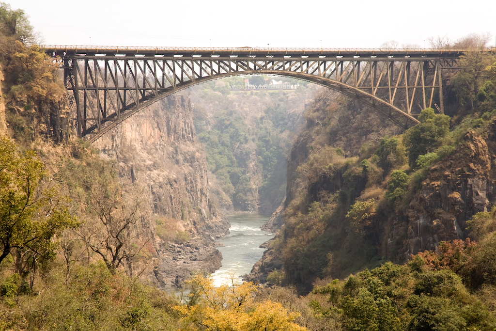
For about 500km / 310mi it serves as the border between Zambia and Zimbabwe, thundering over the Victoria Falls and through the narrow, steadily deepening Batoka Gorge, providing a fantastic playground for white-water rafters.

Its unique value is that it is less developed than other rivers regarding human settlement and many areas along its banks have even been granted protected status. The Lower Zambezi National Park flanks the river on the Zambian side and Mana Pools National Park on the Zimbabwean side. This whole area of the Zambezi supports one of Africa’s most important wilderness areas as it provides sustenance to a diverse array of game, birdlife and fish species.

The Zambezi also supports several hundred species of fish, some of which are endemic. Important species include cichlids that are fished for food, as well as catfish, tigerfish, yellowfish and other large species (the bull shark is sometimes known as the Zambezi shark after the river but it is actually found around the world).

After having provided power, food and transport for many people, and a home for untold numbers of wildlife, the river ends its journey through Mozambique and out towards the Indian Ocean.

The Zambezi’s most noted feature is Victoria Falls but there is so much more. Other notable waterfalls include the Chavuma Falls at the border between Zambia and Angola, and Ngonye Falls, near Sioma in Western Zambia. There are two primary sources of hydroelectric power on the river, the Kariba Dam (which provides power to Zambia and Zimbabwe) and the Cahora Bassa Dam in Mozambique, which provides power to Mozambique and South Africa. There is also a smaller power station at Victoria Falls.

Hippo, Nile crocodiles and monitor lizards, are commonly found along many of the calm stretches of the river. Species of birds, like heron, pelican, egret and African fish eagle are found in large numbers here. The riverine woodlands then support many large animals, such as buffalo, zebra, giraffe, elephant.
MORE INFORMATION

  • The main tributary of the Kariba dam
  • Africa’s fourth most extensive river system after the Nile, Congo and Niger Rivers
  • Basin area of 1 390 000 km² / 836 705mi²
  • 2 574km / 1 600mi long
  • Flows through six countries: Zambia, Angola, Namibia, Botswana, Zimbabwe and Mozambique
  • It glides over several waterfalls
  • It contains grade V and VI rapids (meaning the river has never been a means of long-distance travel)
  • The annual flood of the river hosts the Kuomboka festival (which means ‘to move out of the water’)
  • The river passes through seven national parks

Different times of the year provide completely different experiences along the Zambezi. The peak flood-season between March and April is the best time to experience the full power of Victoria Falls in all its glory (although sometimes the spray is so dense the actual Falls aren’t that visible and ponchos are definitely needed). At this time, the Barotse Plains are also in flood, creating a beautiful delta hosting a plethora of animal and bird species.

For those looking for a little adventure, white-water activities are possible almost year-round, taking into account the water level for different classes of rapids. The river reaches its lowest around November and December after the long dry winter, which coincides with peak safari season.

The Zambezi starts in Zambia and before flowing through eastern Angola, along the eastern border of Namibia, the northern border of Botswana, along the border between Zambia and Zimbabwe, into Mozambique and finally the Indian Ocean. Making the river very accessible from multiple points in Zambia, as well as across many countries across southern Africa.

The most accessible place is to drive or fly to Livingstone in Southern Province, which is a short distance from the Zambezi and Victoria Falls. Trips to Lower Zambezi National Park are also an easy way to see long, serene stretches of the river.

The river has supported villagers for thousands of years and Mosi-au-Tunya (Victoria Falls) was considered a sacred site on the Zambezi.

The first known European to come across it was Vasco da Gama, in January 1498, who anchored at what he called Rio dos Bons Sinais (‘River of Good Omens’).

In 1851, Dr David Livingstone first heard of the magnificent waterfall but his expedition to find it only set out in 1855. He spent the night on an island just upstream of the Falls, after having come down the river by foot, before setting off in a small canoe the next morning to approach the mystical and thundering smoke with the assistance of local guides.

The Zambezi has since been harnessed at various points along the way including the massive Kariba Dam between Zambia and Zimbabwe and Cahora Bassa Dam in Mozambique to provide hydroelectric power.

The Zambezi runs through six countries on its journey from central Africa to the Indian Ocean, and its raw power has carved the spectacular Victoria Falls and the zigzagging Batoka Gorge.

It begins its journey as an insignificant little spring in the corner of north-west Zambia in the Mwinilunga District and bubbles up between the roots of a tree, very close to the border where Zambia, Angola and Democratic Republic of Congo meet.

Over two million years ago, the Upper Zambezi used to flow through what is now the Makgadikgadi Pan in Botswana. However, as a result of tectonic uplift, a vast lake was formed, and the river shifted eastwards – dividing the Limpopo and Zambezi rivers.

The Middle Zambezi was then formed by the western tributary of the Shire river, almost 1 000km / 620mi east in the southern extension of the East African Rift in Malawi. This river eroded a deep valley, moving west, and aided by rift valleys along its east-west axis. It then captured some south-flowing rivers such as the Luangwa and Kafue, and eventually the large tributary of Makgadikgadi – the Upper Zambezi.

With the Middle Zambezi being about 300m / 985ft lower than the upper-Zambezi, a high waterfall formed at the edge of the basalt plateau. These were the meagre beginnings of the first Victoria Falls, somewhere down the Batoka Gorge near where Lake Kariba is now.